How to get to Ile de Ré
Île de Ré is located halfway down the west coast of France, between Nantes and Bordeaux. The island is connected to La Rochelle by a bridge, making it easy to get there.
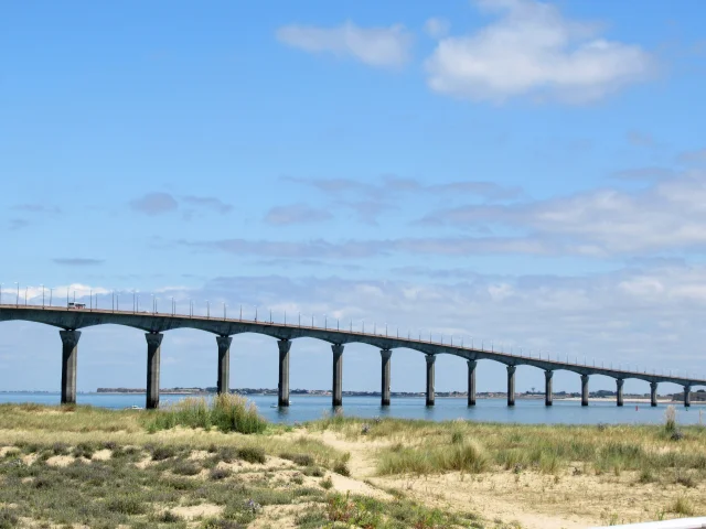
The Île de Ré bridge was inaugurated on 19 May 1988. It connects the mainland (La Rochelle) to Île de Ré, curving over the water for 2.9265 km and reaching a maximum height of 42 m above sea level.
To get to the bridge, follow signs for ‘Île de Ré’. The toll (péage in French) goes towards an eco-tax, which funds initiatives and measures to protect the island’s natural environment.
Alternatively, just before the bridge toll booth, you can follow signs for ‘Le Belvédère’, where you will find a car park, a view of the bridge, a bar-restaurant, and the bus stops (for buses and shuttles over to the island).
When crossing the bridge from La Rochelle, you will see the port of La Rochelle (La Pallice) on your left.
As you arrive on the island, you will see the Pointe de Sablanceaux (Rivedoux-Plage) and its beaches (Plage Nord and Plage Sud).